 jagd
Your hunting ground.
On every phone.
Hunting map with wind and distances, cull plan, open seasons, events and photos – for the management, area leaders and every member. Runs in the browser and installs like an app.
- Servers in Germany
- No ads, no tracking
- Large text, large buttons
Every high seat. Every game trail. Every wind.
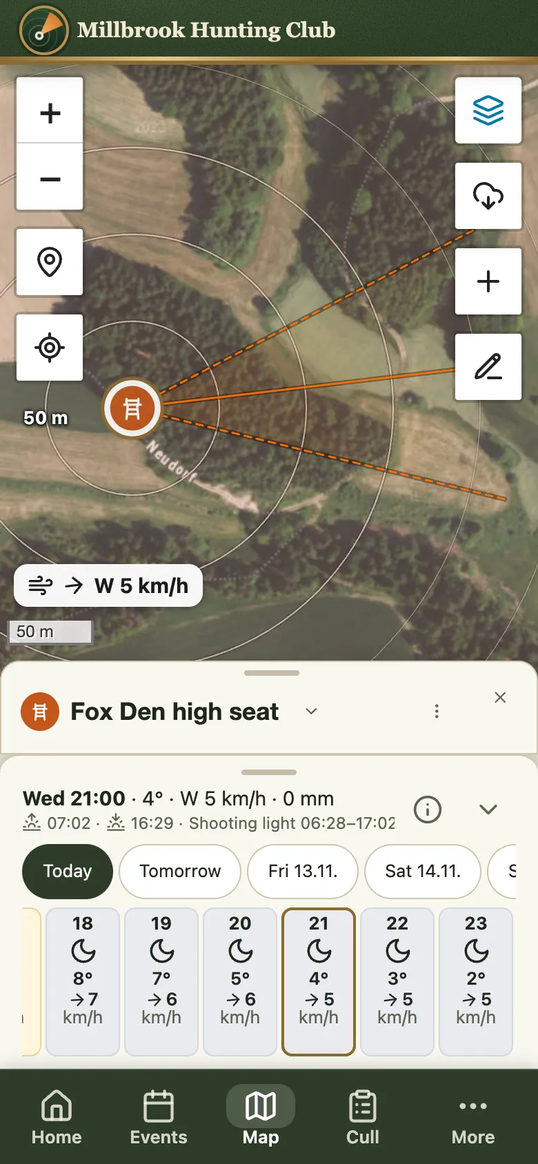
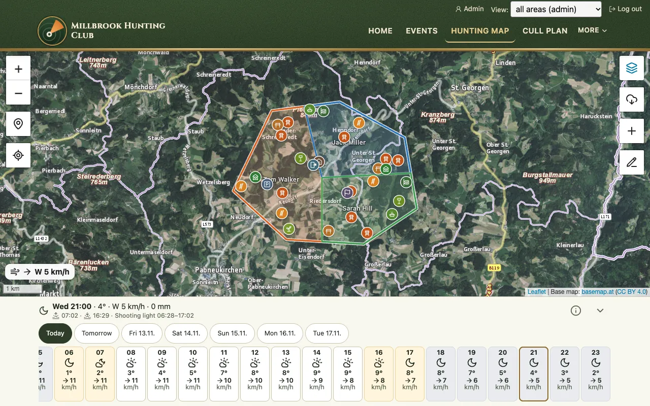
Every facility of your hunting ground on aerial photo and map – with the wind that is blowing there right now.
- Scent cone at the high seat: shows where your scent drifts – plus rings from 50 to 250 m.
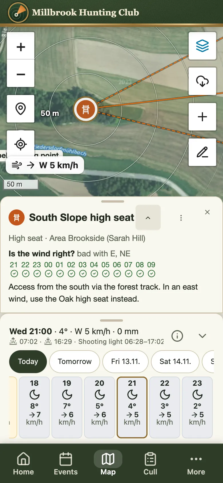
- Is the wind right? For every high seat, hour by hour – with the wind directions where it does not work.
- High seats, ladder stands, bait sites, feeders, trail cameras – each area keeps its own up to date.
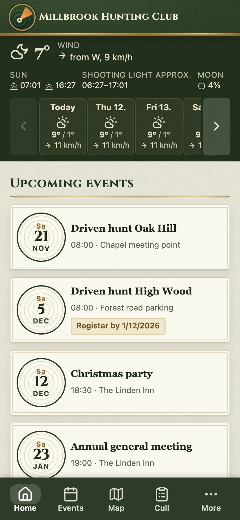
- Weather for 7 days, hourly for your ground, with shooting light, moon and a warning when the wind shifts.
- Save it offline – for woods without signal.
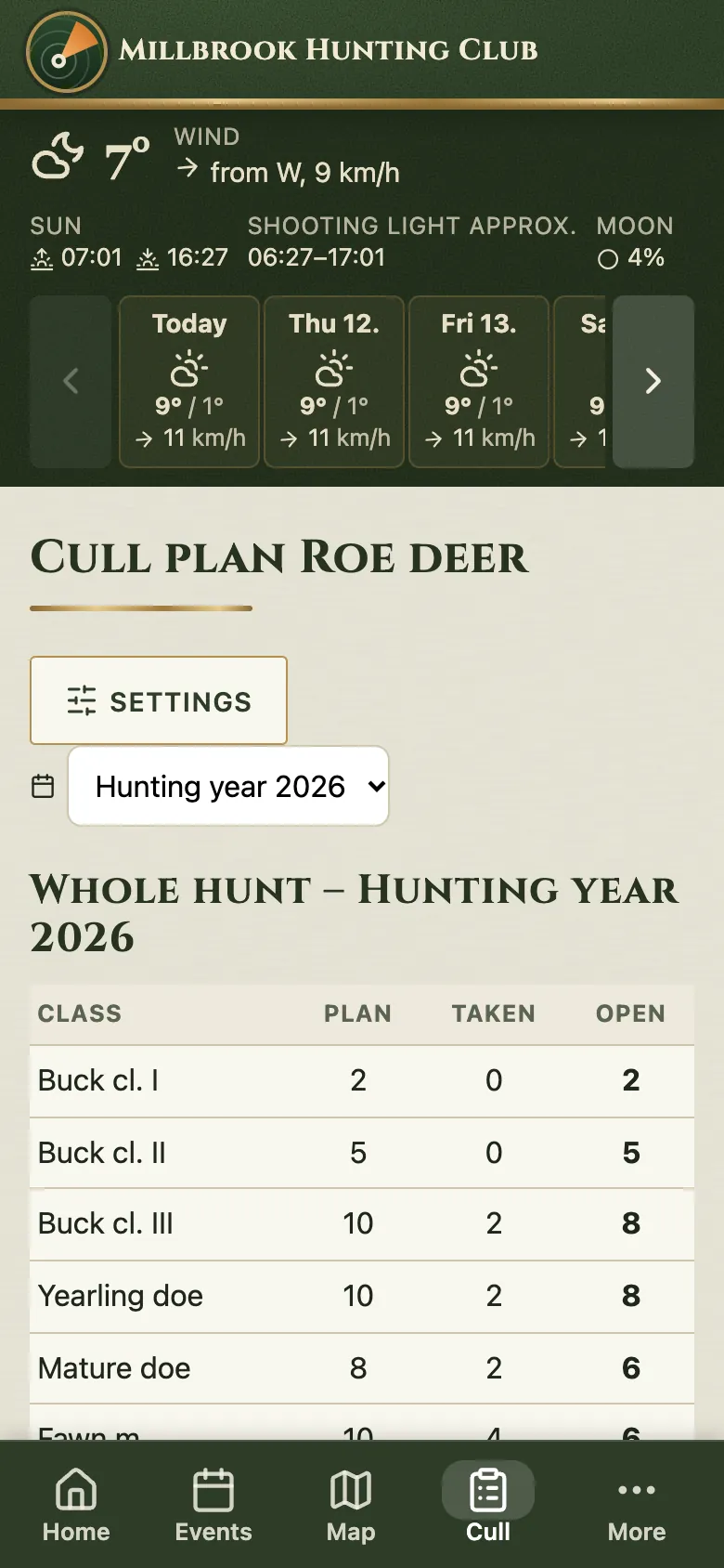
Plan, taken, open – at a glance.
Area leaders record a cull with one tap, and the management sees the state of every area at once.
- Quick to record: choose the class, press plus – with “Undo” in case of a slip.
- Open seasons built in from the rules of the state – Upper and Lower Austria so far, more to follow.
- Export as PDF and CSV, past hunting years stay on record.
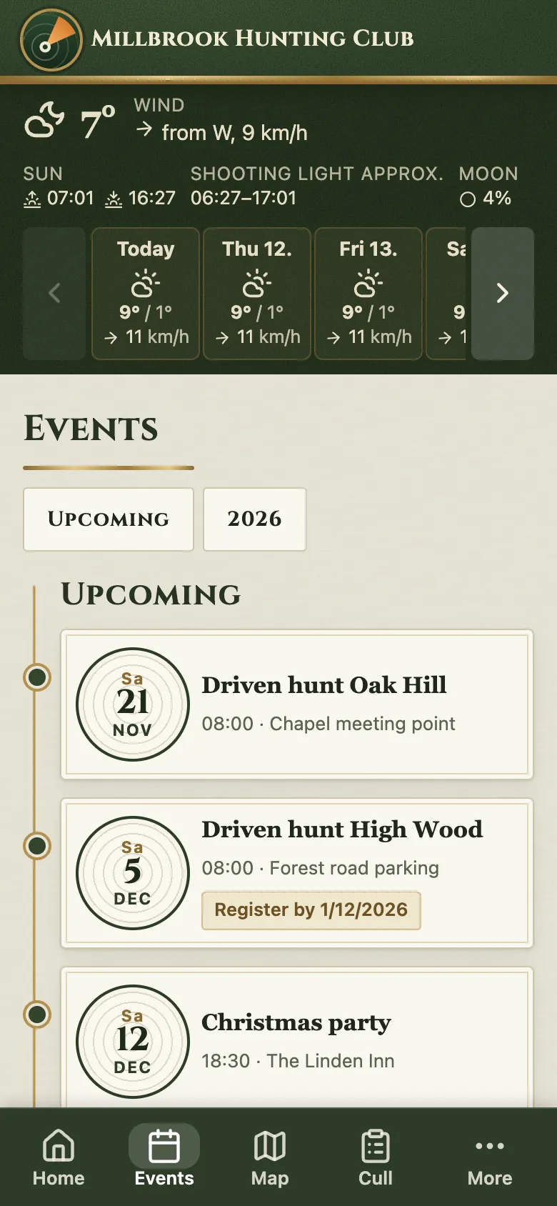
Everything the club needs to know.
Driven hunts, St Hubert’s mass, trophy shows: events, news and photos in one place – instead of scattered across chat groups.
- Subscribe to events in your own phone calendar, with registration deadline and cancellation notice.
- Photo albums straight from the phone – for an event or on their own, optionally just for your own area.
- News and thank-yous for everyone, and a public page for visitors if you like.
Out at the high seat, at home at the desk.
The same app on every device – area borders and facilities are easiest to edit on a big screen.
Everyone sees what they need.
Log in with your mobile number and a code by text message – no password to forget.
Management
Sees every area, manages members, access and content.
Area leaders
Keep the facilities and cull plan of their own area up to date.
Area hunters
See their area with map, wind and facilities.
Members
Events, news, photos and the general places.
As much as you need.
Features can be switched on and off per club. Whatever is not needed does not show up anywhere.
Just the map
Hunting map with wind, weather and facilities. Members land straight on the map.
Members’ app
Events, news, photos and contacts – without the map and cull plan.
Everything together
Map, cull plan, open seasons and club life, with a public page if you like.
your-club.jagdify.comReady at once, no domain of your own needed.
your-club.comOn the club’s own domain.
members.your-club.comNext to an existing website – with a single DNS record.
Your data stays your data.
Area data, facilities and culls are only visible to those allowed to see them – checked on the server.
Data centre in Germany. No ads, no analytics services, no selling of data.
Changes to area borders and the cull plan are saved with their history, exports at any time.
See your own hunting ground in it.
Tell us briefly how your club is organised – we will set up a trial version with your hunting ground and are happy to show it to you in person.